Hoi An, Vietnam. Sue Tsang, 2010.


Showing posts with label volcanoes. Show all posts

Friday, 8 April 2011

Tongariro! Tongariro! Part 2.


Mt. Ngauruhoe

This is taken from the other side of Mt. Ngauruhoe. Its an absolute BEAST, and even as we were looking back at it, I was like, I don't believe we just climbed that monster. Ughhh so crazy. It was so tough. There's something beautifully eerie about barren volcanic land. I love it. You really need to experience it to understand I think. It's amazing, everything is so calm, and quiet...

It was 2.30pm at this point, and we were not even half way through the trek yet. The map said another 4-5hrs at least so there was concern that we wouldn't finish before dark. We were the last ones from the group who set out at 8.30am. Even the guys with the big 60l packs were in front of us. One of the girls (Hi Michal) was on a diet so she had only eaten vegetables the night before. She just needed a piece of bread. I would have been struggling (a lot more) if I didn't have any carbs for fuel.

Okay, onwards! There was another steep rise, it was one of the last ones. We could see a lake from the top of Ngauruhoe so we already knew what was waiting ahead. I kept looking back at Ngauruhoe, and felt a real sense of accomplishment. It already looked so far away. I think all the waiting at the bottom of Ngauruhoe had drained spirits a little. Maybe we were getting tired? I dug out my iPod, and put on some music which gave me a lift. Dancing along.

The red crater was waiting at the top. It's great that there's something at the top to make you go whoaaaa. The emerald lakes are here too. The colours were unreal. Our bus driver at the beginning of the day said there was a lot of sulphur in these pools, and advised us not to swim in them. One of the 60l guys put his pack down, and went towards the water to have a closer look. Then he dipped his hands in, and cupped up some water. Maybe I should have said something to him? His hands were still there when they came back out so nae danger! He was cupping them like he wanted to wash his face though. I think I would have cried out then. Wow, imagine if his hands had melted off... There were helicopters circling the area during our climb up Ngauruhoe but I didn't notice them in the late afternoon. I don't actually know what happens when sulphur touches the skin so I might be speaking rubbish.

Emerald lakes

Not bad. Colours were amazing. The smaller one behind had red around its edge. Not bad at all.

Mt. Ngauruhoe, and the smoking red crater

Clear lake

From here, we followed a path along a cliff edge... The descent was coming up, I could sense it. The bus driver had warned us it was the hardest part, and my memories from Aso, in Japan reminded me that going downhill is rubbish. Constantly catching yourself.

Lake Taupo in the background

Nil at this point had raced ahead because he was fed up of waiting. What really peeved me a little was that the path down would wind from one side to the other. If they just made it straight DOWN, fine. Or maybe not... but I hope you can understand my stress. I could just see the path weaving from one side to the other. We were probs about 8.5hrs into the trek at the point. I wanted to sit down again. And then the path took us up some steps, I was like, what is going on?!?! We're going down!! Meanwhile, Nil had reached the hut, and we could see him. Also apparently the hills are alive with echoes, and the man in front of us could hear everything we were talking about. We were talking about tampons. One of the girls thought Scotland would not have applicator tampons, (we do) but yes random chat, I agree.

This is the view back up. Ngauruhoe, the emerald lakes, the red crater are all behind that mountain. My snacks were finished, I was tired, and my feet hurt but we still had like 1.5hrs of downhill left. There is a hut on the way down with 20 bunks but a crazy wind up there. We pushed on through.

The end of the trek goes through woodland so we had to hurry before it got dark. We only had one torch if it came to that so we had to move on. Down, down hill. It felt like a couple of my toe nails were going to fall off. I wish I had some sort of sponge at the top of my shoes to cushion the constant downward walking.

The forest walk lasts forever!! I thought it was a trap, walking through this woodland forever, the path to nowhere. We did see some deer, or apparently horses are more common in the woods though. We scared them so didn't get to say hi.

It felt so good to come back into the clearing. Our car was still there, phew, apparently there is lots of crime in these car parks. Only 3 cars left so we weren't the last ones after all. I was completely drained at this point. I took my shoes straight off to check my toe nails were still there, and did some stretching while we waited for the others.

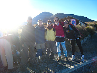
We were a colourful team. Nil was not colourful enough to make it. He did make it, just not into the photo. I think he took this photo. Photo by Nil on Annie Leavitt's camera!

Tongariro Crossing (click for the track). One of the best things I've done to date.


All photos by Sue Tsang, unless otherwise stated.

Tuesday, 29 March 2011

Tongariro! Tongariro! Part 1, Ngauruhoe.


The Tongariro Crossing is often marketed as the best one day hike in New Zealand. I had a quick look at the website, and it looked amazing. It was going to be my 2nd climb around a volcano since Aso, Japan. Tres excitement.

The weather really makes a difference on a mission like this so I was anxiously checking the report (which changed its mind like twice a day) to make sure the day we planned to walk was going to be a clear and beautiful one!

We drove from Auckland, and it was a nice ride. It was during the week so we mostly had the road to ourselves apart from a few big delivery lorries. Michal booked us into stay at Club Habitat which had a motel look going on. It was pretty ghetto but did the job for two nights.

Over dinner we discussed how we were going to get to the national park. The shuttle buses offer to take you to the start of the trek for $20/$40 for return. Since we had a car we were reluctant to pay this price- it would have been $200 alone on transport, we said pfft! Many options were discussed, we tried to ask if anyone else was doing the trek the next day so we could share a lift; hitch hike; just pay the shuttle. Turangi is closest to the END of the trek, I didn't know this, and just thought it would have been closest to the start so I don't think my input in the discussion really made any sense. ANYWAYS, after phoning the bus company, we decided to drive to the end of the trek, and then jump on the 7.30am bus which would take us to the start of the trek. The woman at the hostel reception told us we could only buy return tickets. Don't believe her lies.

Ok, so the next day we wake up at 6am happy as can be, and eat some breakfast. Porridge with a banana, tea, toast. Energy, energy. It was really cold, and I was tired but also kinda nervous and excited.

Scenic lookout point! (NZ roads signs are pretty accurate)

8.30am

In NZ, they call this sort of activity, 'tramping'. You can see Michal's tramping gear which consists of thermals with shorts on top. So many colours! We weren't going to lose her.

The trek starts off relatively easy until the part where you start climbing up towards Ngauruhoe. There are huts dotted off the trek so some people were doing it with all their camping gear, like 50l packs. I don't know how they managed it.

Ngauruhoe in the background.

Mt. Ngauruhoe is the biggest peak in the crossing. Its a monster, and its not part of the trek so there is no path. We had all decided before that we were up for climbing it, and there were several others already half way up by the time we got there.

Looking up Ngauruhoe

Not sure if the above photo does it much justice but it was small grey rocks at the bottom which were easy enough to walk over, and then it changed to like black ash so every time you took a step you would slide down a little which, you know, isn't ideal. Two of the group went racing ahead, and I was kinda in the middle on my own but it was good just going at my own pace. I would stop every now and again to look back at my progress, absorb the view, take some photos, drink some water. It was tough! Definitely a mental challenge as well as physical.

Michal, and Annie

Keep on, keepin' on. I think you can get a sense of what it was like from the above photo. Nothing for miles, crumbly rocks, crazy steep gradient, and tiny little figures following me up.

After a while, these big boulders appear, and people were climbing over them and I was thinking to myself what would take less energy- to walk round the side of them and use my arms to help pull myself. Or climb over the boulders. I did the first option for a while but it was getting tough with no gloves, and the people in front of me who climbed over them seem to have created some distance so I tried that after a while. When I turned back, I couldn't even see Michal and Annie anymore. Boulders must have been huge. Then the rocks change again, to red and kinda less crumbly but still very loose under foot. I could see Nil, and Molly at the top, and my tummy was rumbling and I just wanted to sit down for a while, and eat, and not have to climb, haha.

Anyways, just as I'm about to climb up the last few boulders to the top, I hear a grumble. Which was scary because it echoed for ages, (I know it wasn't my tummy), and I thought to myself, it can't possibly be an active volcano otherwise we wouldn't be allowed to climb it. Why is it grumbling then?!! To the left there was a smoking peak, and the sulphur was a lot stronger here. I look up at the others who are already up there, and they don't seem too concerned about the noise so I carried on pushing to the top.

TOP OF THE WORLD! I love that feeling when you reach the top. TOP OF THE WORLD.

THE CRATER

The view from the top. MEAN.

Take a hat for the top, its gets really windy, and an extra layer too for when you're eating your sandwiches and cooling down! We stayed up here until everyone was up, and just relaxed for a bit. I was thinking as I was going up, hmm, this isn't going to be easy coming down...

yikes!

These rocks were LOOSE. I found the best way was just to have one foot in front and slide. It created a small avalanche of sorts but there was no one directly below me. I had cleared a path with my path but didn't let Annie use it because she was sending rocks tumbling down after me, pretty scary. This sliding down gets a bit tiring, and boring after about 10 minutes. Took me about 40 mins to get down. Can you imagine sliding for that long! It was fun though because there was no path you actually had to think about what you were doing. I loved it.

Ok, the whole trek took us 10hrs so I'm going to break this into two parts...

http://www.tongarirocrossing.org.nz/


Friday, 8 October 2010

Volcano city!


Our hosts in Kyoto recommended Aso- san for a visit so we made the trip there after a day trip in Hiroshima. Aso is one of the largest calderas in the world. It`s like a wee town in a big basin surrounded by mountains and trees. We didn`t realise it was goin to take so long so we were goin up the mountains in the dark, the driver had to walk down the platform and change the direction he was driving twice in order to get up this mountain, and of course we couldn`t see what was goin on outside! It felt like we were goin back on ourselves but somehow when changing seats he must have changed the tracks too.


It was a torch job from the station but luckily the hostel wasn`t too far away. It felt like a cabin in the woods, probably the least Japanese of our accomodation so far. We still had to change into slippers though!


We didn`t realise til morning how great a location we were in. The bus up to the top of the mountain took 30 mins. Most people then opted for the cable car but we walked it and soon we were peering into the bubbling volcano crater. Each time there was a breeze we could smell the sulphur. Pretty horrible because I could taste it too, ummm.

Bubblin' crater of Mt. Nakadake


Our reading of the area didn`t really prepare us for the size of the place. It was huuuuge, and so many different terrains- orange rocks, ash soil, rocks, patches of grass. It was ace.


Volcano bomb...


We started scrambling up the hill. It was all rocks but there was arrows pointing us in the right direction. I felt pretty nervous actually, just because I`ve not really walked up near any volcanoes before!! Each time we turned round the view got better...


Even at this point it had been a tough climb, 1270m to go!

The view at the top was unreal. 360... smokin crater in one direction, mountains in the other, wee caldera town and then more rocks to climb. We reached the peak of Nakadake and we were unsure what to do because the descent was roped off. The tourist info said the path was closed because the cable cars had been abandoned; our hostel owner too said it was officially closed but that we could still walk it if we liked. We were wary, I didn't really want to double back on ourselves but being so close to a bubbling crater I was a bit on edge, and it did look like quite a long descent into unknown ground... humm... anyways we soaked up the view while debating what to do for a while then 5 Japanese guys came down from the highest peak, Taradake, and after exchanging some konnichiwa's they continued down the roped off hill. Should we just follow? Yeahh, let's go!


The otherside of the smoking crater!

The path was very crumbly, so we carefully stepped over the No Trespassing tape and started our descent. It was exciting and fun, and I figured if we were stopped by any officials the Japanese guys would be able to talk to them haha.


Top of the world!


Pete has been on field trips before albiet not right next to a bubbling volcano, but I dunno, this guy could explode any moment, I felt uneasy and walking down next to a rusty, abandoned cable car station it was eeerie for sure but exciting!! The path was fine, not sure why it was closed exactly. There was no cable cars hanging in the sky so there was no danger in that sense. One of the look out points did pretty much look into the crater so needless to say we didn't stay at that observation point for long. The Japanese guys did so we passed them at this point and continued down, I kept checking behind me because for some reason I felt safer knowing there was other hikers coming down this 'closed' path.


My legs hurt more coming down then they did going up!! I was at times holding on to Pete and going down walking backwards, as in heels first. I've not really used going down hill muscles for an extended period of time. This was like a 1.5hr descent. I don't even know what the muscles are called, but continuously having to catch yourself, ouch my wee legs.


We finally arrived at a car park which marked the end of the trek although the train station back to Aso was 2km from here. We bought some drinks and prepared ourselves for more down hill walking. The 5 guys had their own car otherwise I'm sure we would have asked to share a ride or a taxi with them. We were pretty gutted because there was no space for us in their car! We started walking with our thumb out.


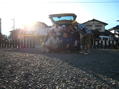
I think only one van passed us, and he didn't stop!! We saw him snake his way all the way down the hill so he was going in that direction anyway. He was bowing as he drove past hehe so polite. I guess he was in a hurry or something. Anyways the 5 Japanese guys stopped for us! They pulled over and just laughed and then opened up the boot so we were getting ready to climb into the boot but he got two of his pals to sit back there so we could sit in the back seats. They spoke very little English but we managed to get some chat. They were firemen and paramedics so I guess helpful people :-) they dropped us right at our hostel, and then asked if they could take a photo with us. It was ace. I love Japan.

Hai, cheesu!